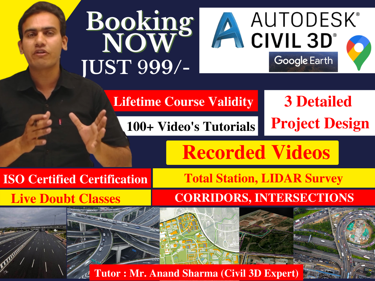
During & After Completion, What you will get - 1. COGO Points Files 2. Survey Database 3. Total Station Files 4. Theodolite Files 5. Highway Chainge Files 6. LIDAR Survey Files 7. Earthwork Calculation Data 8. Cut & Fill Report 9. Highway Geometric Design 10. Corridor Modelling Files 11. Site Analysis Report 12. Lifetime Software Support from PTS CAD EXPERT 13. Free Workshop on Latest Updates 14. Lifetime Videos Access 15. SketchUp Digital Books 16. Industrial Updates 17. Software Installation Support 18. Certification (Authentic Certification) 19. Surface Topography Analysis Report 20. Upto 60 Technical Files 21. IRC Technical Codes and Reports 22. Assembly Details This Course is Completely Dedicated to Civil Engineers, Who deal with several challenges in Survey & Transportation design, Please check the entire syllabus for Civil 3D, Here is the list of Sessions - Session - 1 Introduction - Land Survey - Land Development - Transportation Design - AutoCAD Civil 3D - Working Environment - Work Space - Tool Space - Object - Object Style - Label Style - Template - Creating Reports Session - 2 Working with Point Data - Creating and Editing Points - Miscellaneous - Intersection Session - 3 Working with Point Data - Creating and Editing Points - Slope - Interpolate - Point Styles - Point Group - Import/Export Points Session – 4 Surface - How to create a surface based on Points - Modifying Surface - Surface Styles - Surface Label Styles - Create Points from Surface Session – 5 Project Exercise (creating COGO points by giving easting, northing, and elevation ) Session – 6 Survey: Total Station - Creating Survey Database - Creating Survey Network - Creating Figure Styles and Prefix - Importing Field Book - Working with Survey Data - Creating Surface Session – 7 - LiDAR Survey - Introduction to LiDAR - How to Import LiDAR Survey Data - Creating Surface - Working with DEM files Session – 8 - Surface Analysis - Direction - Elevation - Slope - Slope Arrow - Water Shed - Water Drop - Catchment Area - Legend Table Session – 9 - (Exercise- creating surface by using different methods of surface creation ) Session – 10 - Earthwork Calculation - Create surface by - Break lines - Contours - Drawing Objects - Alignment Creation - Horizontal Profile View generation - Customizing Profile Views - Create a Volume Surface - Volume Calculation Session – 11 Grading - Xref - Combining Surface from multiple files - Global Coordinates Session – 12 Parcel - Site - Creating Parcels - From Object - By Layout - Creating Right Of Way - Editing Parcels - Labelling Parcels Session – 13 - Parcel - Site - Creating Parcels - From Object - By Layout - Creating Right Of Way - Editing Parcels - Labelling Parcels - Creating Tables Session – 14 Project: create surface contour , apply labels on it, find cut and fill as per requirments) Session – 15 - Alignment Design as per IRC - Design Criteria Editor - Alignment from Polyline - Alignment Style - Alignment Label Style - Design Criteria - Design Check Set - Alignment by Layout - Edit Alignment Geometry - Tables - Best Fit Alignment - Create Offset Alignment - Create Widening Session – 16 - Profile Design as per IRC - Profile by Layout - Multiple Profile Views - Super Imposed Profile - Edit Profile Geometry - Design Criteria Editor - Profile View Labels Session – 17 Create profiles of given alignment as per IRC Session – 18 Assembly - Create Assembly from Library - Create Sub-assembly from polyline - Assembly Offset Session – 19 - Corridor and Corridor Surface - Create Corridor - View/Edit Corridor Sections - Super Elevation - Corridor Surface - Corridor Surface Boundaries Session – 20 - Junction Design - Manual Junction Design (based on versions before 2010) - Automatic Junction Design - Customize the Assemblies - Corridor Surface Session – 21 Roundabout Design - Add Approach - Add Turn Slip Land - Create Corridors - Corridor Surface - Grading - Feature Lines - Grading Surface - Label Session – 22 - Quantity Takeoff - Sample Lines - Section Views - Compute Materials - Earthwork - Material Quantity Takeoff - Creating New Criteria Session – 23 - Pipe Network - Parts List - Pipe Network by Layout - Pipe Network from Object - Edit Pipe Network - Draw Parts in Profile View - Create and Apply Rules - Pipe Network Labels - Pipe Network Tables Session - 24 Railway Engineering Track Design as per IRS Code Session - 25 Highway Drainage System Canal Design Session – 26 - Project: Transportation Design Session - 27 - How to Create Surface by using Google Map